Bagolino
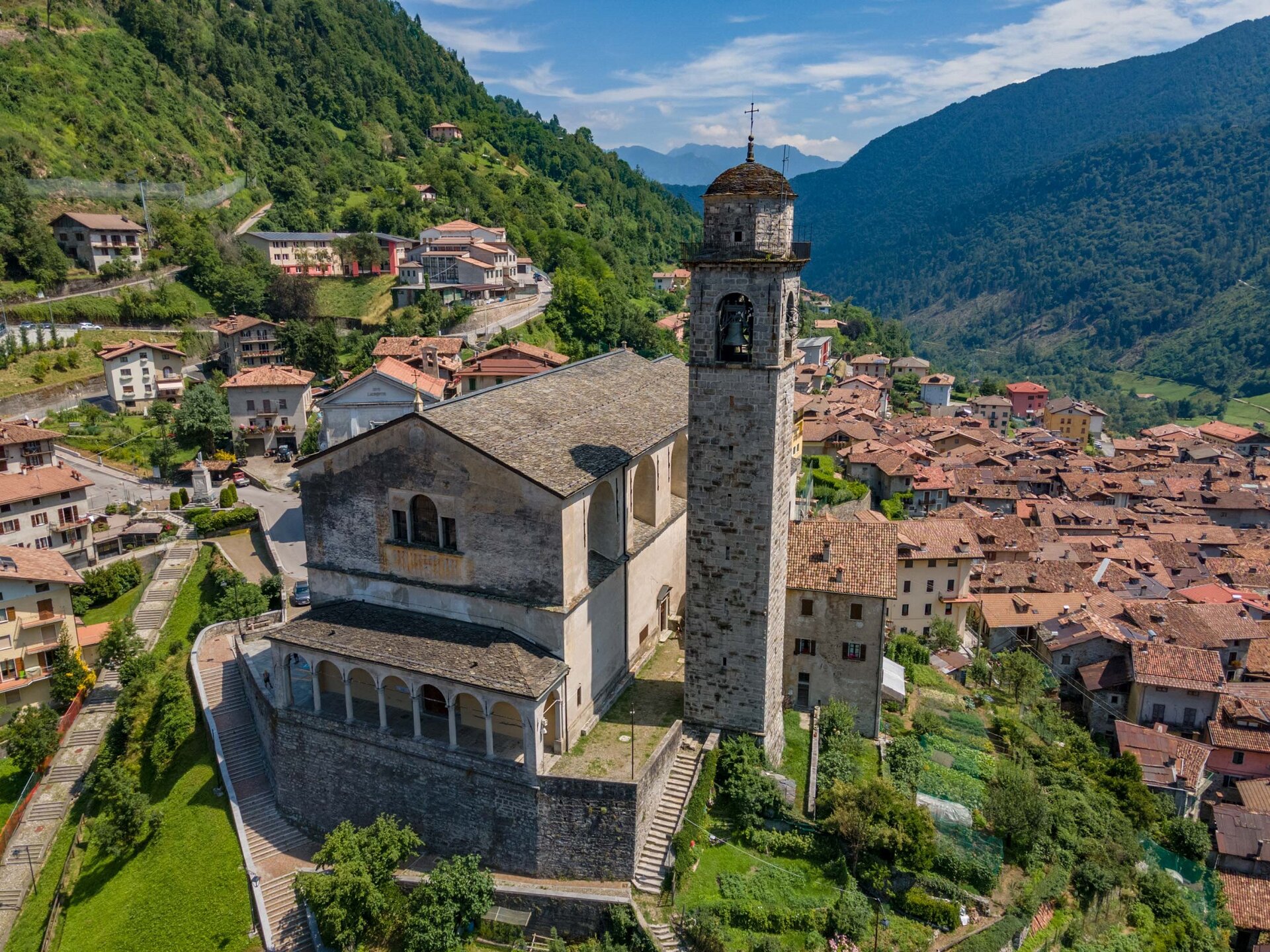
A route that connects the shores of Lake Garda with the medieval gem of Bagolino. The route features some short but fairly challenging climbs. Starting from Gargnano at the former Caserma Magnolini (0.0 km), you travel along Via Libertà heading south, leaving Villa Bettoni behind until you reach the roundabout where you will take the road to Villavetro. Surrounded by olive trees, continue until the hamlet of Zuino, where there is a rather steep climb. After passing the houses, you continue on Via Alpestre until you reach Via Angelo Feltrinelli, which leads to Navazzo. From here, take the Provincial Road 9 in the direction of Valvestino and, surrounded by lush vegetation, cycle until you reach the dam and the blue waters of Lake Valvestino (12.1 km). When the water level is not particularly high, you can see the remains of the old Austro-Hungarian customs house. At the junction of the SP9 and SP58, take the latter towards Capovalle (17.7 km). In these approximately 5 km, human presence is almost completely absent, and you can hear the sounds of nature. After passing through part of the town up to the votive chapel of San Rocco, a long descent begins. Past the tunnel (32,7 km), you can start to glimpse Lake Idro through the foliage. After crossing the centre of Idro and the bridge over the Idro-Vobarno Canal, take Via Lungolago Italia, then Via Roberto Bertini until you cross the bridge over the Chiese River. Here, at the next stop, turn right and follow the signs for Trento. Continue for about 2 km until you reach Anfo and stay on the Strada Provinciale BS237 until the large roundabout after the village of Sant’Antonio (46 km), and take the second exit towards Bagolino. Continue on Via San Giorgio until you reach the Parish Church of Bagolino (55.2 km), from which you can enjoy a splendid view of the valley.