Dal Garda a Brescia
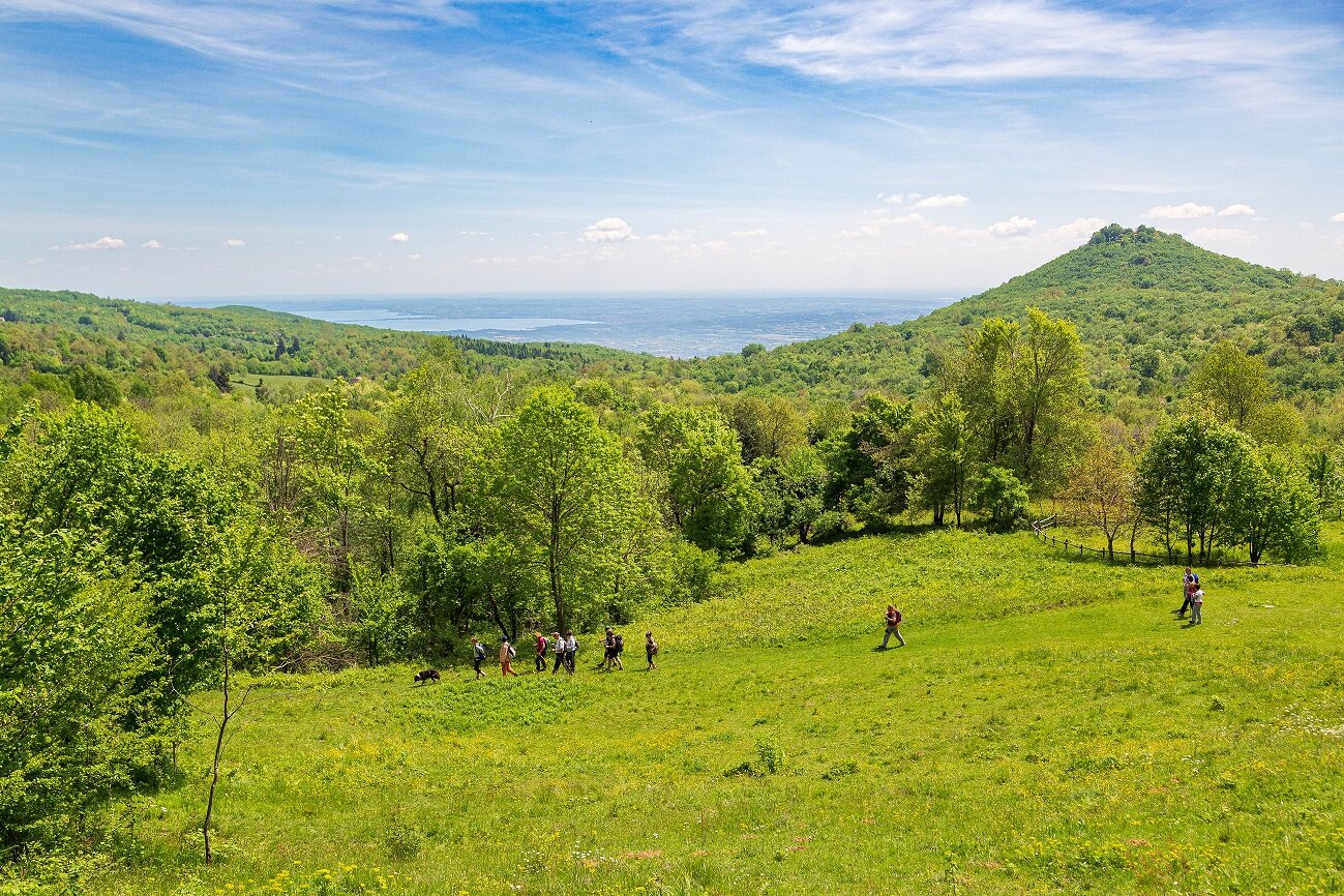
This magnificent trek from Lake Garda to Brescia, which we recommend completing over two days, traverses a wild landscape that alternates between woodland and farmland, dotted with old farmsteads and offering incredible views across the lake to the Apennines! Start from the Zanardelli lakefront in Salò and continue until you reach the pretty hamlet of Campoverde, where the climb begins through the ridge of moraine separating the lake from Valle Sabbia at Bocca di Croce (4.1 km, 318 m asl). After a gentle descent, initially hidden among the woods, you reach the cycle path. Follow this to pass Villanuova sul Clisi and the Chiese river (8.6 km, 214 m), along beautiful Via Romana, to reach Sopraponte (10.5 km, 212 m asl). Here begins the longest and most demanding ascent of the route, along trail 503, 502, 501, which takes you to the wooded peak of Monte Tre Cornelli (15.5 km, 877 m asl). From here, follow signs 520 and 530 along an undulating track through woodlands dotted with bird-hunting blinds and hides to the Cariadeghe Plateau Natural Monument, whose extraordinary beauty can be fully appreciated from the top of Monte San Bartolomeo (21 km, 933 m asl), the highest point of the entire itinerary and an extraordinary viewing point. The area is ideal for an overnight stay if you choose to complete the itinerary in two stages. Still following signpost no. 530, start the long descent past Valpiana (22.3 km) and then Castello di Serle (24 km), before coming to Colle San Vito (26.8 km, 546 m asl), after passing the little church of the same name. Intercept the blue-white 3V path, which takes you all the way to Brescia, first uphill to Monte Salena (28.5 km, 862 m asl), then on the flat to Monte Maddalena (30.3 km, 870 m asl) and finally, after a long descent, the numerous hairpin bends of via Panoramica and the walls of the Castello del Colle Cidneo (36.8 km), to the gates of the city. Here you find yourself among the beautiful and fascinating streets of Brescia's historic centre, where at Piazza Vittoria (37.5 km), after admiring the cathedral and Piazza Paolo VI, you reach the end of your trek.