Limone sul Garda - Tremosine sul Garda
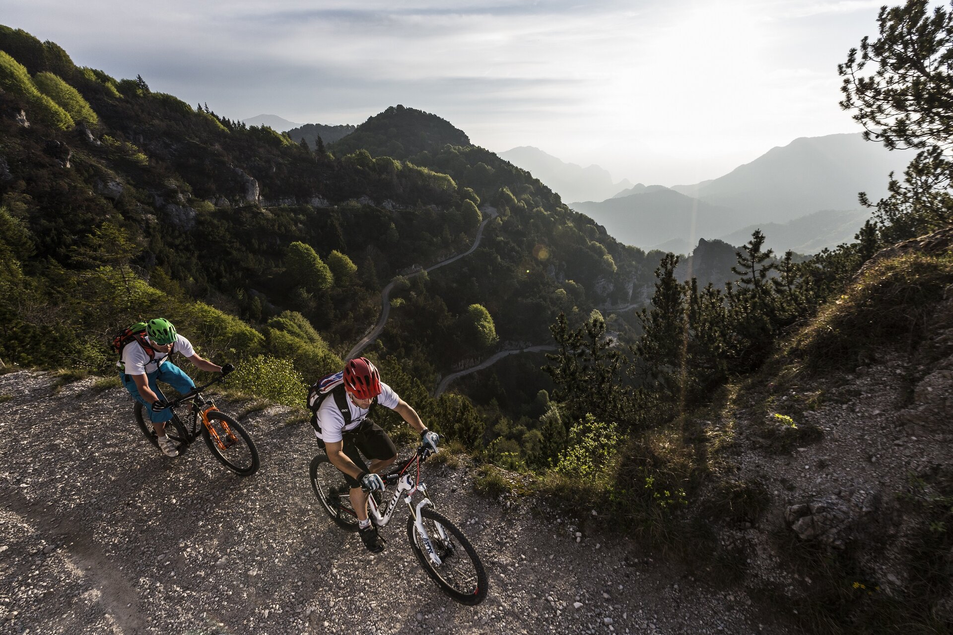
The ring that connects Limone sul Garda to Passo Tremalzo and drops back to the lake along the valley Singol is one of the most famous and aspired routes of the Garda area, reserved for experienced cyclists for its length and altitude difference. From the Limone sul Garda lakeside (0,0 km) you climb up to the Western Gardesana Road, turn left. After a few hundred meters you turn right following the sign for Tremosine sul Garda, climbing up an uphill slope with some steep and tiring sections to ride, and with wide views of the lake. It passes from Bassanega and Voltino and goes first to Vesio, and from here in direction of Tignale. Follow the road into hamlet Polzone (10,7 km) and at the crossroad you turn right onto the road with indication of the Tremalzo Pass. Along the left side of the San Michele valley descends to cross the stream, beyond which begins a long climb that leads immediately to pass beside the hermitage. It is a very challenging ride but largely rewarded by the beauty of the surrounding natural landscapes where woods and rocks extend. Beyond the crossroads for the Lorina alm (21,8 km) and the waterfall of Prà di Lavino you will reach first the Cà de l’Era alm and then the Alm Ciapa, beyond which there are three more bends to the Garda refuge on the Tremalzo Pass (29,2 km, 1702 m asl). You still have to climb a bit more to reach the Bocca di Val Marza, where a tunnel marks the highest point of the itinerary (1865 m asl). The road that follows, which dates back to World War I along with shelters and observation points carved in the rock, is spectacular and fun, and goes down connecting to the one rising from the valley of Bondo. From here you follow the indications for the Nota pass (38,4 km, 1208 m asl), the Bestana pass (1274 m asl) and the Segala hut. Not far from this, near the Guil pass, turn right onto path n0. 117, which with a series of technical steps leads down to the Singol valley, along which we descend returning in the village of Limone sul Garda.