Dal Garda a Montichiari
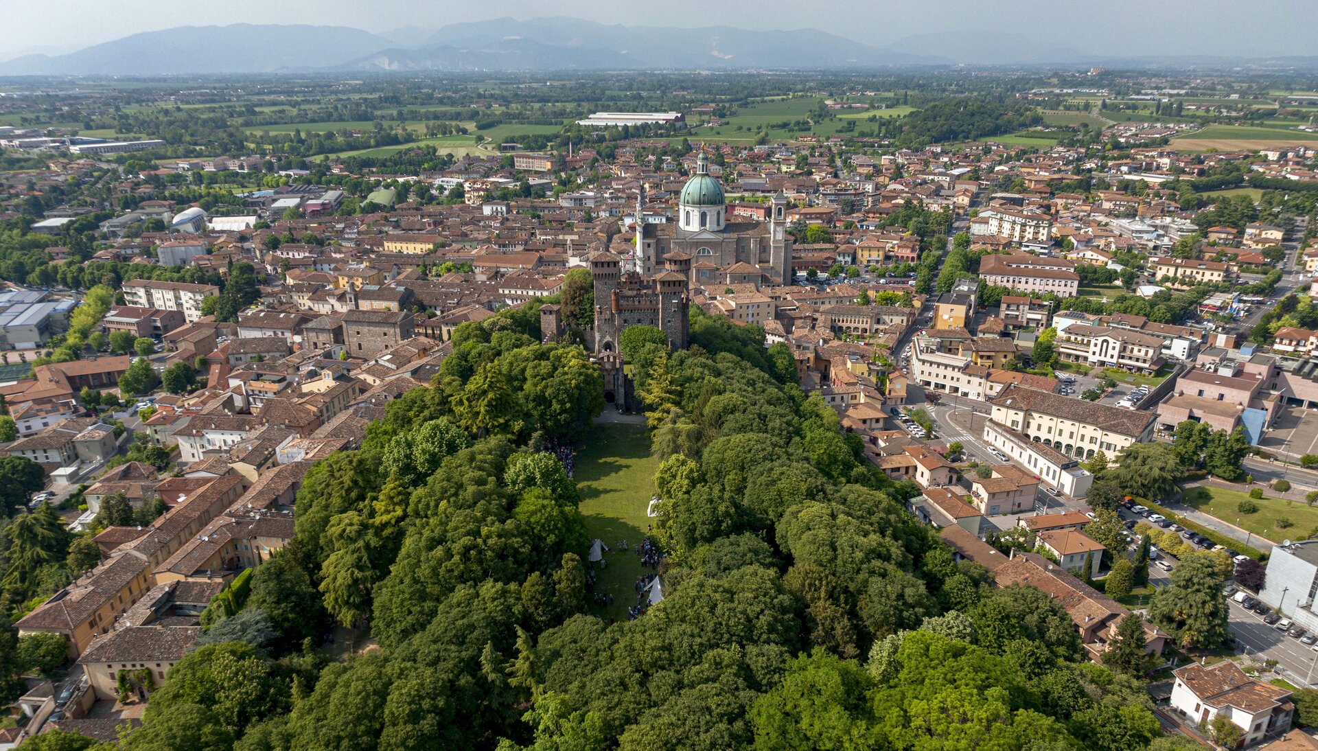
Touring the hills and rural plains close to Lake Garda, this route begins at the Desenzano del Garda lakefront, at the old harbour, and continues in a northerly direction up to the roundabout, to climb along via Gramsci and via San Benedetto until it crosses the cycle route to Brescia along via Reciago (2.5 km). Cycle to Maguzzano with its beautiful Benedictine abbey (4.4 km) and immediately afterwards tackle the short and only steep section of the entire itinerary, leading to Barcuzzi, the highest point of the hike (6.2 km, 212 m asl). Continue on a slight and pleasant descent, following the signs for the cycle route to Brescia, through pleasant cultivated fields until you pass Sedena (7.6 km) and reach Salaghetto (13 km) on the outskirts of Bedizzole. Turn south along the cycle route to Montichiari via Campagnola and reach the banks of the River Chiese until you reach and cross Ponte San Marco (16.6 km) followed by the railway line and finally the motorway. At Calcinato (19.0 km), continue following the signs for the cycle route to Montichiari, amidst beautiful views of the surrounding countryside, which you will come to after faithfully following the course of the River Chiese. Head for the San Pancrazio pass (29.6 km, 129 m asl), where there is a parish church of the same name and a war memorial. Join via Trieste and head east to via Mantova until you turn left onto via Boschetti Sopra. At the roundabout, at the velodrome, turn right onto the long, straight dirt road that will take you via delle Cocche to Esenta (38.7 km). Go through the small village to take the beautiful dirt road of via Vallone that skirts the foot of the green hill until it meets and follows via Brodena, which will take you to Lonato del Garda (45 km). It is worth taking a short diversion to visit the castle. Otherwise, follow the signs for Barcuzzi, where you can make your way back to Desenzano del Garda along the same route, or take a different route along via Breda and via Santa Giulia to Lido di Lonato del Garda (50.7 km) and then along the lakeshore to the Desenzano del Garda lakeside port.