Gardone Riviera

Difficulty
Intermediate
Activity time
4:00
Duration in hours
Distance
12
Distance in km
Suggested period
Jan
Feb
Mar
Apr
May
Jun
Jul
Aug
Sep
Oct
Nov
Dec

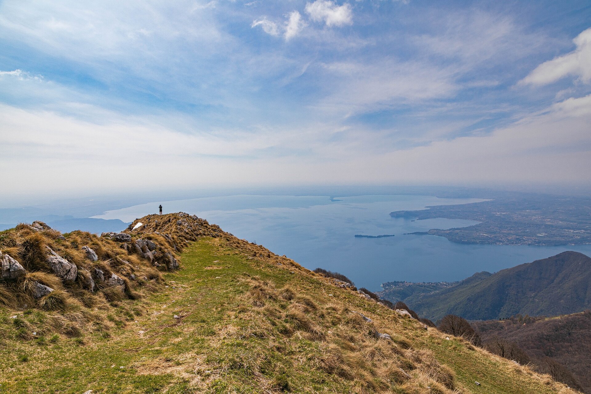
Leave from the village il Pirello (1030 m asl), going uphill on the asphalted road with the signs to path no. 280 headed to Rifugio Pirlo. After a steep beginning, the path continues on a relatively delicate slope. After a clearing, it enters the wood on a plain trail and, through delicate ups and downs, will take you to Passo di Spino (1160 m asl) between Monte Spino to the North-West and Monte Pizzocolo to the South-East. You will also see some buildings and the crossroads to Rifugio Pirlo on your left. At Passo di Spino, following the old military road going uphill on the right among large beech trees, after some hairpin bends you will reach Dosso delle Prade (1352 m asl). From here continue northwise along a narrow military road offering a series of views on the lake. After a few curves the lake reappears, then the path continues among large beech trees. Beyond the itinerary that reaches Sarnico, you can carry on the last section of the trail through to Bivacco Due Aceri, always open but not guarded, which takes its name from the presence of two old maple trees close by the building, which is a restored version of an old Great War location. From here you reach the top of Monte Pizzocolo (1581 m asl) from which you can enjoy beautiful views of Monte Baldo, Lake Garda, Valvestino, Prealpi Bresciane and, on sunny days, also the Apennines. Close by the top there is also the church dedicated to the victims of war. Following the same itinerary you will reach the starting point. It is possible to leave on foot also from Colomber: in this case you should count an hour and a half more on departure, and an hour on your way back. To reach il Pirello village, get to San Michele then to Colomber. Here, close by an old wash house, keep your right and follow the directions to Rifugio Pirlo.

Route info
Intermediate
Distance
12,0 km
Activity time
4 h 00 min
Highest point
1.581 m
Safety guidelines

Make sure you take with you all the necessary equipment and clothes for excursions according to the season. Check the weather forecast the day before your trip and verify that the track is open on the day you choose. During the excursion do not deviate from the signalled path, respect the highway code and the environment, do not leave your waste along the path. The viability of the routes may not necessarily coincide with the indications, it needs to be verified permanently and periodically on the ground. The Author declines any responsibility for any accidents or damages that may occur on the proposed routes. 

Single emergency call number: 112

Punto di partenza

Gardone Riviera, car park locality il Pirello, 1030 m slm

public transportation

San Michele can be reached by bus (www.arriva.it), the other villages are not served by public transport lines.

How to get there

San Michele can be reached from Salò and Gargnano. Parking areas available in Colomber (405 m above sea level) and in l Pirello (1030 m above sea level), but to reach the latter you must follow an untarmacked road, at times particularly rough, for about 5 km. Don’t forget: safety first.

You might be interested in
Discover related tours
Intermediate
Moniga del Garda - Soiano del Lago
Distance 15,6 km
Activity time 4 h 30 min
Intermediate
Gargnano
Distance 7,5 km
Activity time 5 h 30 min
Difficult
Tremosine sul Garda - Limone sul Garda
Distance 15,0 km
Activity time 5 h 00 min
Easy
Tremosine sul Garda
Distance 10,0 km
Activity time 4 h 00 min
Intermediate
Magasa
Distance 10,6 km
Activity time 4 h 00 min
Difficult
Valvestino
Distance 13,0 km
Activity time 5 h 00 min
Our main partners