Gargnano
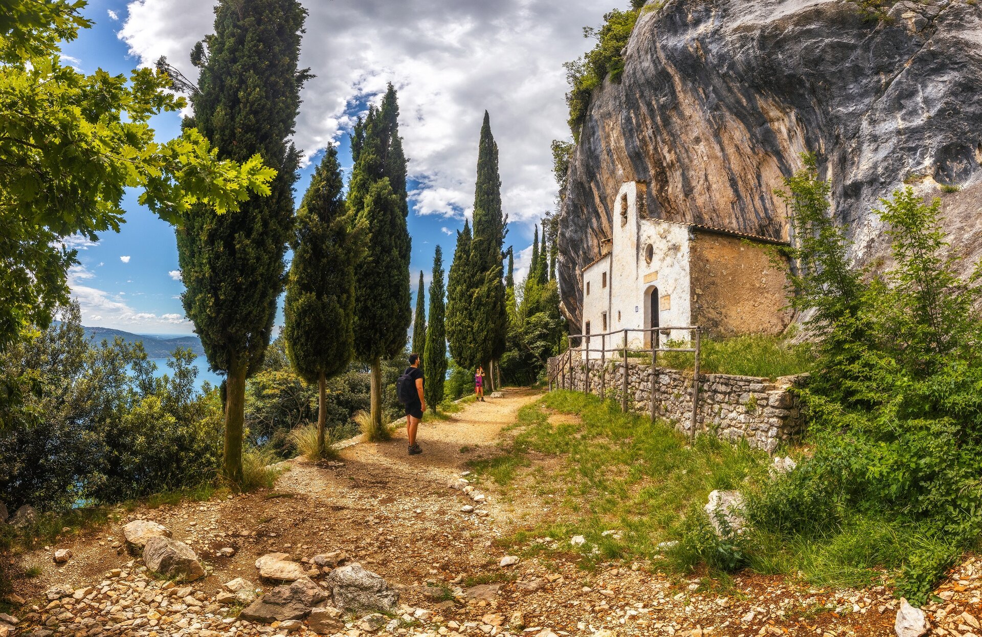
As you leave the carpark in Sasso (546 m asl), walk past the charming and well-maintained village along the main road and, once beyond an ancient washhouse, where you can still meet people who wash their clothes there, take the track following the directions to Mount Comer and Eremo di San Valentino (path no. 231). The path, with steep stretches through dense woodland, just beyond a small valley, goes uphill to a belvedere over the lake; the first viewing point, which will leave you breathless. Here, a pause is a must, before continuing on your way. If you walk past this panoramic point, on the right you will see the crossroads leading to Eremo di San Valentino (path no. 230B, 772 m asl). We recommend, either on the outbound or the return journey, a diversion from the route to see the Eremo (hermitage). In a stunning location atop a steep rock face overlooking the lake, the dazzlingly bright white building perches as through grasping the chalky rocks that support it. At the crossroads further up, if you continue on the path that unwinds through a chestnut tree wood to a small plateau, you will find a deviation to Briano and the Rifugio degli Alpini di Gargnano, where you may stop by on your way back. The uphill path continues on the right and touches the border of the mountain affording beautiful glimpses of the lake below through dense woodland, and culminating at the top in a breathtaking and unforgettable view of the lake. As you walk past a repeater you will reach the top of Monte Comer (1279 m asl) where you can see Monte Baldo, the Prealpi and even the Appenines on a cloudless day. Walking back from the top, head northbound along paths 231 and 232 , gently descending along the western sides of the mount toward a beech tree wood to the Rifugio Alpini di Gargnano (1027 m ASL). From here, once you reach the asphalted road leading to Briano village, turn on the path on your left (path no. 231A) that descends in the wood before joining an uphill trail. Follow this path back to the starting point. It is also worth visiting the nearby parish church of Sant’Antonio Abate, perched amid the hills not far from the village.