Limone sul Garda

Difficulty
Difficult
Activity time
6:00
Duration in hours
Distance
13.5
Distance in km
Suggested period
Jan
Feb
Mar
Apr
May
Jun
Jul
Aug
Sep
Oct
Nov
Dec

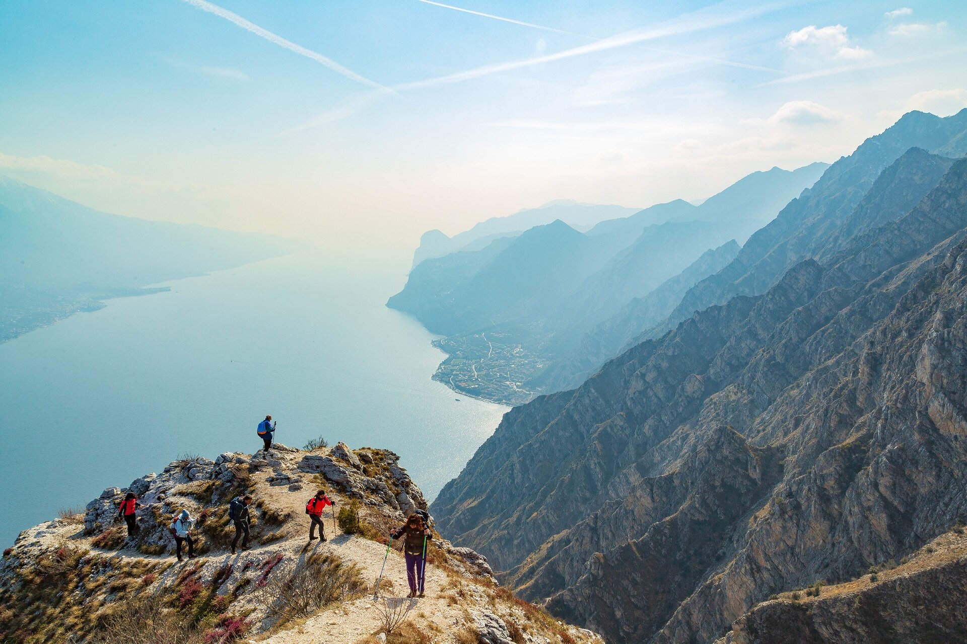
Leaving from the centre of Limone sul Garda, from piazza Garibaldi, continue northwise for over 2 km until you reach the main road. After 100 m, beyond the road, follow the indications to the trekking path no. 122, which coincides here with Sentiero del Sole. Walk through pine trees and cypresses, continue on a stony hill where you will reach a panoramic spot with benches (200 m asl). Here you leave Sentiero del Sole to walk on path no.122, which rises up high on the sides of mount Palaer reaching a very short and flat area, on which you will find a small military cave and another panoramic spot. A short descent will take you to the valley of Larici, then it rapidly goes uphill to Sella dei Larici (880 m asl), at the crossroads with the forestal road from Pregasina, and to Punta dei Larici (905 m asl), a spectacular belvedere on mount Baldo and the lake. If you continue on the left toward the forestal road heading to Malga Palaer (945 m asl), where you can find a spring of freshwater, you will walk uphill on the beautiful path no. 422B among beech trees, until you reach Passo della Rocchetta (1158 m asl). From here you may walk to the left on the path no. 130, an old military road that will take you to Cima Mughera (1081 m asl). Just before this, the road crosses with path no. 101 leading back to Limone sul Garda. The area just below the Mughera top, overlooking Limone sul Garda village, is a splendid panoramic spot with benches to appreciate the view. Walking downhill, the wood meets the cobbled path of Valle del Singol (730 m asl) which takes you to La Milanesa village and back to Limone sul Garda.

Route info
Difficult
Distance
13,5 km
Activity time
6 h 00 min
Highest point
1.158 m
Safety guidelines

Make sure you take with you all the necessary equipment and clothes for excursions according to the season. Check the weather forecast the day before your trip and verify that the track is open on the day you choose. During the excursion do not deviate from the signalled path, respect the highway code and the environment, do not leave your waste along the path. The viability of the routes may not necessarily coincide with the indications, it needs to be verified permanently and periodically on the ground. The Author declines any responsibility for any accidents or damages that may occur on the proposed routes. 

Single emergency call number: 112

Punto di partenza

Limone sul Garda, Piazza Garibladi, 70m slm

public transportation

Limone sul Garda can be reached by bus (www.arriva.it) and by boat with Navigazione Lago di Garda (www.navlaghi.it).

How to get there

Limone sul Garda can be easily reached from the south or from the north part of Garda along the Gardesana Occidentale (SS45bis). Parking is available in La Milanesa or in a covered pay car park near the centre of Limone sul Garda.

You might be interested in
Discover related tours
Easy
Puegnago del Garda
Distance 5,5 km
Activity time 2 h 00 min
Difficult
Tremosine sul Garda - Limone sul Garda
Distance 15,0 km
Activity time 5 h 00 min
Easy
Sirmione
Distance 9,0 km
Activity time 3 h 00 min
Intermediate
Gargnano
Distance 7,5 km
Activity time 5 h 30 min
Easy
Tremosine sul Garda
Distance 10,0 km
Activity time 4 h 00 min
Easy
San Felice del Benaco
Distance 2,5 km
Activity time 2 h 30 min
Our main partners