Salò

Difficulty
Intermediate
Activity time
4:00
Duration in hours
Distance
11.7
Distance in km
Suggested period
Jan
Feb
Mar
Apr
May
Jun
Jul
Aug
Sep
Oct
Nov
Dec

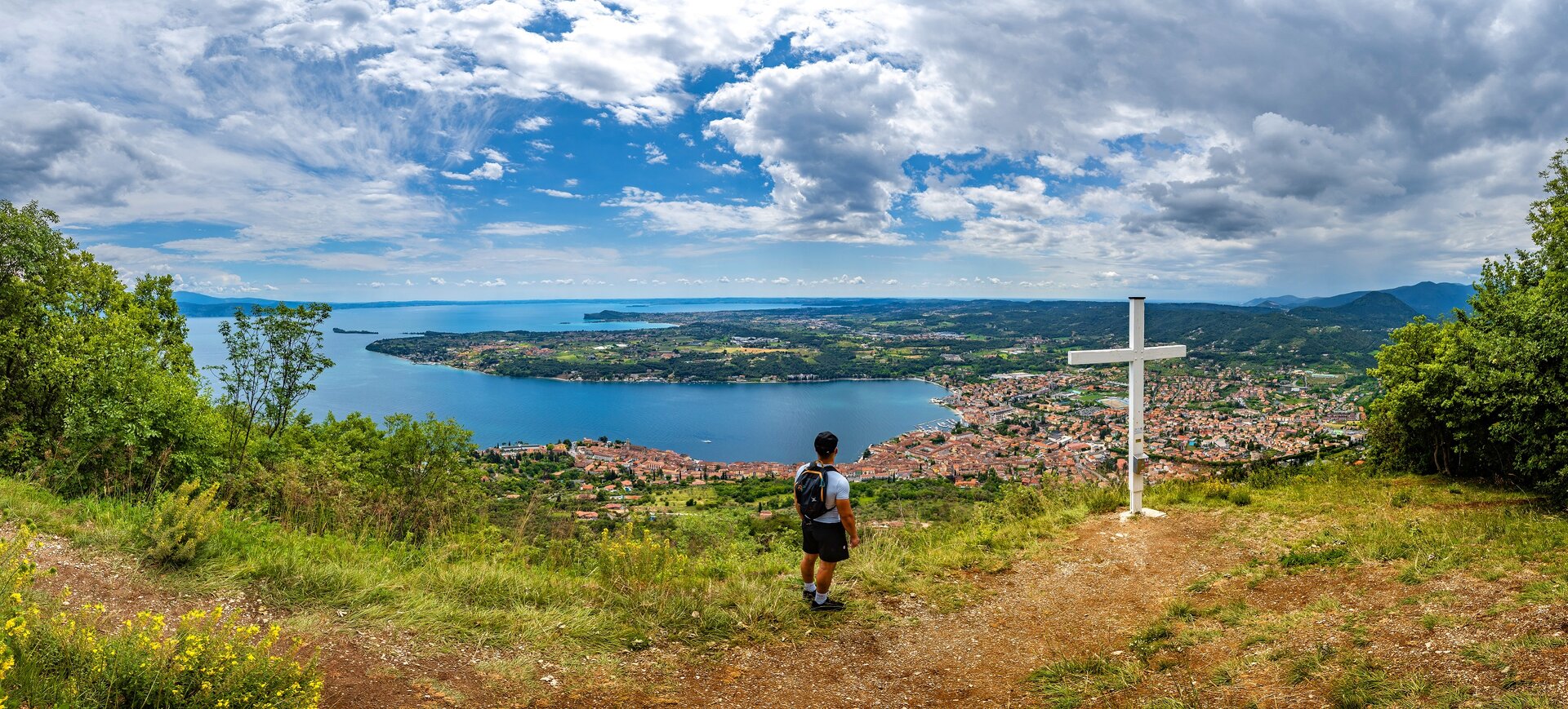
The itinerary begins in the area of the quarter of Carmine, one of the most ancient of Salò, along via San Bartolomeo close by the headquarters of the Red Cross, with signs indicating the trekking of BVG (Bassa Via del Garda) which you will follow up to Passo La Stacca. Once through Strada Statale 45bis, continue to the next fork of the road turning left toward via del Seminario. Nearby a small parking, follow the path that enters a suggestive and thick wood of pine trees. Do not deviate from the main path and go past the alternative road to Renzano, you will see on the right la Corna (387 m asl), a cliff where you must stop by to have an amazing view of the gulf of Salò. Back on your track, exit the wood and reach the 17th century church of San Bartolomeo (465 m asl). On the main path, follow the signs to Bassa Via del Garda to Passo La Stacca (443 m asl), where you will see a hunting hut and a fork in the path: here you leave the directions to Bassa Via del Garda to follow trail no. 217B toward Bagnolo and the Church of Madonna di Bagnolo (504 m asl). Beyond the porch, turn left along path no. 216 to località Milord, full of century-old chestnut trees, on a donwhill path with an alternation of untarmacked road and asphalted road. The itinerary reaches the Church of Madonna del Rio (168 m asl), behind which you can see a cave with a high waterfall. Continuing on the untarmacked road, go past the charming borough of Renzano (176 m asl) and Strada Statale 45Bis, close by Salò. Once in Piazza Vittorio Emanuele II, after having visited the historical centre of the village and its beautiful walk along the lake banks, you will reach the starting point.

Route info
Intermediate
Distance
11,7 km
Activity time
4 h 00 min
Highest point
505 m
Safety guidelines

Make sure you take with you all the necessary equipment and clothes for excursions according to the season. Check the weather forecast the day before your trip and verify that the track is open on the day you choose. During the excursion do not deviate from the signalled path, respect the highway code and the environment, do not leave your waste along the path. The viability of the routes may not necessarily coincide with the indications, it needs to be verified permanently and periodically on the ground. The Author declines any responsibility for any accidents or damages that may occur on the proposed routes. 

Single emergency call number: 112

Punto di partenza

Salò, via San Bartolomeo, 60 m slm

public transportation

Salò can be reached by bus (www.arriva.it) and by boat with Navigazione Lago di Garda (www.navlaghi.it).

How to get there

Salò is easy to reach from the upper lake along the Gardesana Occidentale (SS45bis) or from the lower lake along the SP572. Parking available close by the starting point.

You might be interested in
Discover related tours
Intermediate
Gargnano
Distance 7,5 km
Activity time 5 h 30 min
Easy
San Felice del Benaco
Distance 2,5 km
Activity time 2 h 30 min
Easy
Sirmione
Distance 9,0 km
Activity time 3 h 00 min
Intermediate
Moniga del Garda - Soiano del Lago
Distance 15,6 km
Activity time 4 h 30 min
Easy
Manerba del Garda
Distance 6,5 km
Activity time 2 h 30 min
Difficult
Dal Garda a Brescia
Distance 37,5 km
Activity time 12 h 00 min
Our main partners