Tignale

Difficulty
Intermediate
Activity time
3:00
Duration in hours
Distance
21.6
Distance in km
Suggested period
Jan
Feb
Mar
Apr
May
Jun
Jul
Aug
Sep
Oct
Nov
Dec

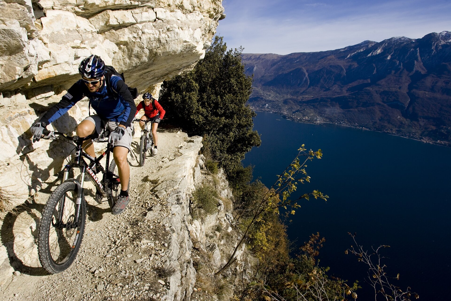
Nestled in the heart of the Alto Garda Bresciano Park, Tignale’s meadows, fields and orchards spread across a plateau, bordered by the woodland’s edge on one side and the shores of the lake on the other. This is the ideal location for walking: set out to discover its charming villages, admiring breath-taking views along the way. In the centre of the village of Gardola, the main village of the council of Tignale, you can park the car in Piazzale Arcobaleno. Cycle towards the village of Olzano. After you passed through this small village, continue to ride on the road that leads into the forest until you reach the Alpine hut at Cima Piemp (7 Km, 1160 m asl), a great place to take a break and enjoy the breathtaking panorama, sweeping from Lake Garda and Monte Baldo towards the mountains of Valvestino and Trentino: incredible in every season. After the Cima Piemp hut the road carries on and becomes a dirt track that runs along Cima di Traval and Cima delle Carbonere: this stretch is characterized by a long downhill. Straight after this another climb is required in order to reach Passo d’Ere (11,7 km, 1131 m asl). At this point, carry on riding along the main track following the trail sign no. 253 for 7 Km. The following locations will be touched along the route: Bocca Paolone (947 m) and Passo Fobia (907 m asl). Stay on the path no. 253 and you’ll reach the location of Vione (694 m); here at the junction, keep left and take the path no. 251 towards the village of Aer. Following this track for about 2,4 Km you will reach the village of Aer. From here, after 1 Km, you will be back in Piazzale Arcobaleno, the starting point of the tour.

Route info
Intermediate
Distance
21,6 km
Activity time
3 h 00 min
Highest point
1.100 m
Safety guidelines

Make sure you take with you all the necessary equipment and clothes for excursions according to the season. Check the weather forecast the day before your trip and verify that the track is open on the day you choose. During the excursion do not deviate from the signalled path, respect the highway code and the environment, do not leave your waste along the path. The viability of the routes may not necessarily coincide with the indications, it needs to be verified permanently and periodically on the ground. The Author declines any responsibility for any accidents or damages that may occur on the proposed routes. 

Single emergency call number: 112

Punto di partenza

Tignale, Gardola, 555 m slm

public transportation

Tignale can be reached by bus (www.arriva.it)

How to get there

You can reach Tignale from the Gardesana Occidentale (SS45bis), or from Tremosine sul Garda. Parking is available in the Piazzale Arcobaleno.

You might be interested in
Discover related tours
Intermediate
Valvestino
Distance 16,5 km
Activity time 3 h 30 min
Intermediate
Salò-Puegnago del Garda
Distance 15,5 km
Activity time 2 h 00 min
Easy
Dal Garda a Montichiari
Distance 53,8 km
Activity time 4 h 00 min
Intermediate
Toscolano Maderno-Gargnano
Distance 22,3 km
Activity time 2 h 30 min
Easy
Lonato del Garda
Distance 15,7 km
Activity time 2 h 00 min
Intermediate
Valvestino
Distance 28,9 km
Activity time 2 h 30 min
Our main partners