Toscolano Maderno

Difficulty
Easy
Activity time
3:00
Duration in hours
Distance
6.7
Distance in km
Suggested period
Jan
Feb
Mar
Apr
May
Jun
Jul
Aug
Sep
Oct
Nov
Dec

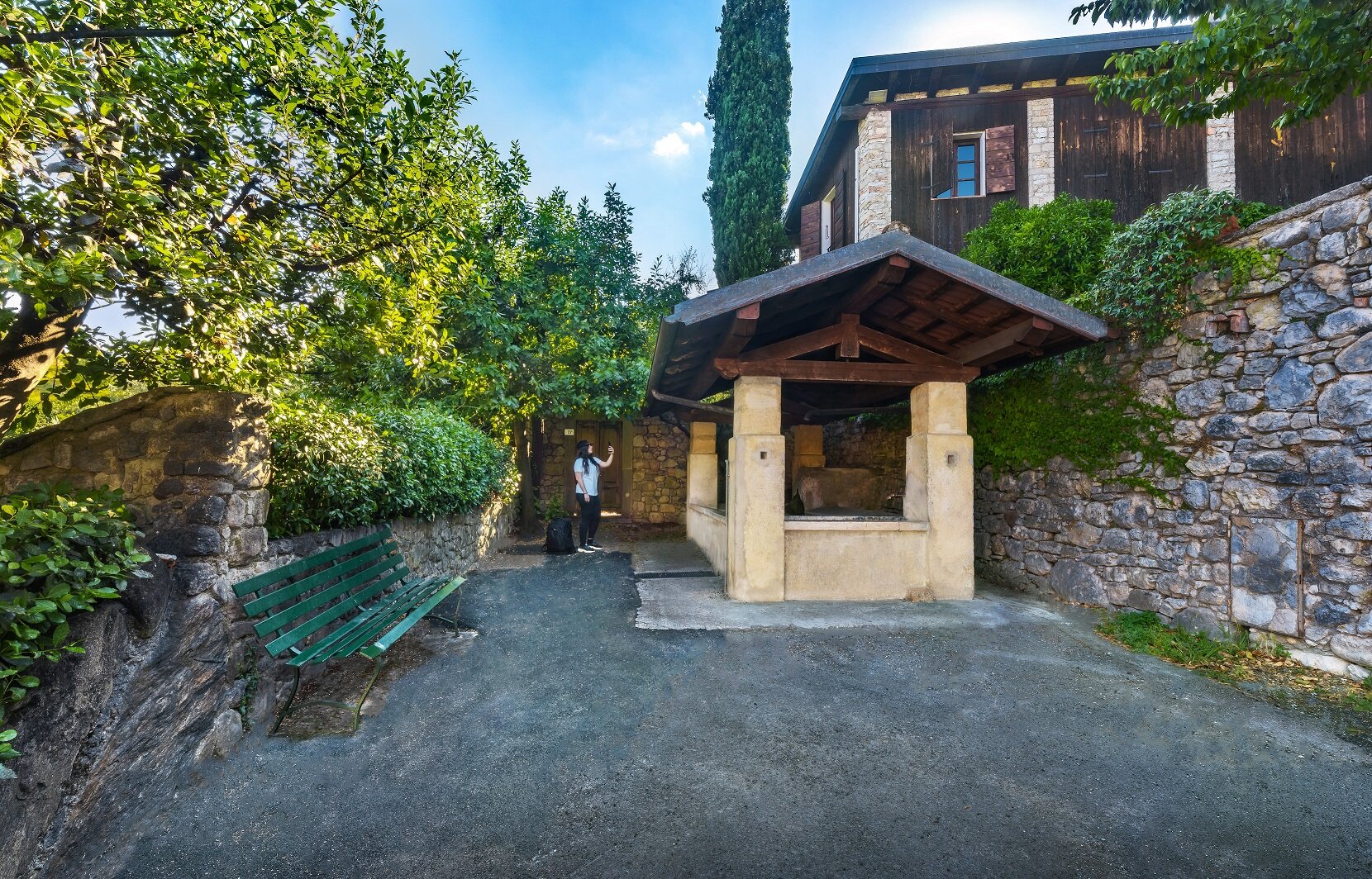
From the parking place of the Bornico Cemetery (100 m asl) it follows for a few meters up the paved road to Fasano Sopra until, on the right, you take via Bezzuglio.  Until the mid-20th century, the country lane which leads to the village of the same name (206 m asl) through terraces and olive groves, was the main communication link between the village and the lakeside towns. Here an old washhouse with a fountain appears immediately, and then you discover all the beauty of the small hamlet, continuing between stone walls, old arches in support of the embankments, lemon and stone houses, demonstrating how well the place has retained its rural characteristics. Following the dirt track indicated with BVG (Bassa Via del Garda) to Pezzuglio (287 m asl) and Magnico (333 m asl), in a rural setting planted with vegetable gardens, orchards and olive groves, you arrive at the foot of Monte Pizzocolo, passing a charming waterfall. After a bend and a short climb, stop following the directions for the BVG at Rosei (344 m asl), characterised by a small hill with a beautiful villa padronale surrounded by cypress trees, and take a right turn onto the path which, with beautiful uninterrupted views over Lake Garda,  first goes down to Vigole  (301 m asl) and then, after crossing twice the paved road, arrives in Maclino (220 m asl). After crossing the small inhabited at a “santella”, continue downhill along the path heading south to get into the humble and damp Bornico Valley, touched by the stream with the same name, until you reach the point of departure.

Route info
Easy
Distance
6,7 km
Activity time
3 h 00 min
Highest point
360 m
Safety guidelines

Make sure you take with you all the necessary equipment and clothes for excursions according to the season. Check the weather forecast the day before your trip and verify that the track is open on the day you choose. During the excursion do not deviate from the signalled path, respect the highway code and the environment, do not leave your waste along the path. The viability of the routes may not necessarily coincide with the indications, it needs to be verified permanently and periodically on the ground. The Author declines any responsibility for any accidents or damages that may occur on the proposed routes. 

Single emergency call number: 112

Punto di partenza

Toscolano Maderno, Bornico, 100 m slm

public transportation

Bornico can be reached by bus (www.arriva.it).

How to get there

Bornico is located along the Gardesana Occidentale (SS45Bis) between Gardone Riviera and Toscolano Maderno. Parking facilities at the Cemetery

You might be interested in
Discover related tours
Difficult
Valvestino
Distance 13,0 km
Activity time 5 h 00 min
Intermediate
Gardone Riviera
Distance 12,0 km
Activity time 4 h 00 min
Difficult
Limone sul Garda
Distance 13,5 km
Activity time 6 h 00 min
Easy
Tignale - Gargnano
Distance 6,0 km
Activity time 3 h 00 min
Easy
Polpenazze del Garda - Padenghe sul Garda
Distance 11,0 km
Activity time 3 h 30 min
Easy
Desenzano del Garda - Lonato del Garda
Distance 12,0 km
Activity time 3 h 00 min
Our main partners