Valvestino

Difficulty
Intermediate
Activity time
2:30
Duration in hours
Distance
28.9
Distance in km
Suggested period
Jan
Feb
Mar
Apr
May
Jun
Jul
Aug
Sep
Oct
Nov
Dec

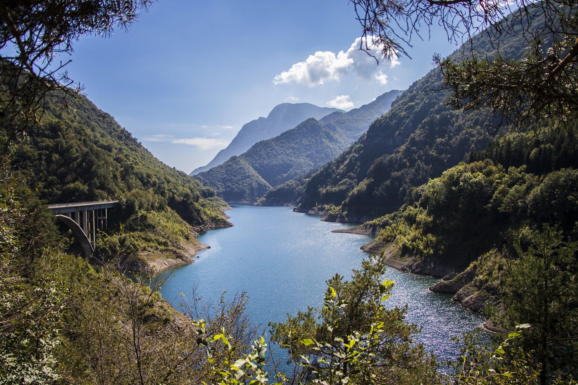
Near a small nucleus of buildings in Molino di Bollone (0,0 km) you can park the car and mount in the saddle of your bike. You start pedaling north and turn a little further to the left on the road leading up to Capovalle. The first stretch with four bends of the lower part of the wooded Valley of Molini is rather steep, then continues on slopes less accentuated to the Passo San Rocco (7,4 km, 946 m asl), a watershed between Valvestino and Valle Sabbia. You descend slightly in the direction of Lago d'Idro for about 600 m, then at the first hairpin bend, turn left in the direction of Passo Cavallino della Fobbia (11.6 km, 1098 m asl). There are some short, particularly steep ascent sections, both on asphalt and on a dirt road, to Cocca Veglie (follow the signs from the Pass) and then to the Fienile di Los (16.9 km, 1325 m asl). The views are stunning! Here you can decide whether to continue along the pleasant route (path no. 474) which leads you across the top of the Camerelle valley and then to the Casello di Vesta (18.7 km, 1389 m asl), where you can enjoy the alpine pastures and barns, green meadows and pleasant views of the Val di Vesta Wilderness area below, isolated and wild, where the Vesta stream meanders, collecting the waters of various side tributaries and creating gorges, waterfalls and the 'fjord' of Lake Valvestino. Otherwise, from the Fienile di Los, you can continue along the dirt track that descends into the forest (path no. 470B) leading back to the San Rocco Pass. Here you turn right and follow the beautiful descent all the way down to Molino di Bollone.

Route info
Intermediate
Distance
28,9 km
Activity time
2 h 30 min
Highest point
1.389 m
Safety guidelines

Make sure you take with you all the necessary equipment and clothes for excursions according to the season. Check the weather forecast the day before your trip and verify that the track is open on the day you choose. During the excursion do not deviate from the signalled path, respect the highway code and the environment, do not leave your waste along the path. The viability of the routes may not necessarily coincide with the indications, it needs to be verified permanently and periodically on the ground. The Author declines any responsibility for any accidents or damages that may occur on the proposed routes. 

Single emergency call number: 112
 

Punto di partenza

Valvestino, Molino di Bollone, 510 m slm  

public transportation

Molino di Bollone can be reached by bus (www.arriva.it).

How to get there

Molino di Bollone can be reached from Gargnano along the SP9 road that runs alongside the Valvestino dam, or alternatively from Idro. Parking is available at Molino di Bollone, near the bridge.

You might be interested in
Discover related tours
Easy
Dal Garda a Brescia
Distance 35,3 km
Activity time 2 h 00 min
Intermediate
Tignale
Distance 21,6 km
Activity time 3 h 00 min
Easy
Desenzano del Garda-Pozzolengo
Distance 22,5 km
Activity time 2 h 00 min
Intermediate
Gargnano-Valvestino
Distance 26,0 km
Activity time 3 h 30 min
Easy
Desenzano del Garda
Distance 20,5 km
Activity time 2 h 00 min
Easy
Dal Garda a Montichiari
Distance 53,8 km
Activity time 4 h 00 min
Our main partners